
'Top secret' D-Day landing maps to go to auction
'Top secret' D-Day landing maps to go to auction
Nr zdjęcia:
4345943
Data:
2025-08-04
Opis:
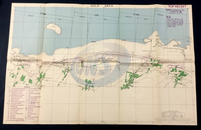
"Top secret" maps used by Allied troops in the D-Day landings are expected to fetch up to £15,000 when they go up for auction.The UK, the US, Canada and France attacked German forces on the coast of northern France on 6 June 1944. It was the largest military seaborne operation in history and involved the simultaneous landing of tens of thousands of troops on five beaches in Normandy.The maps, found in a box of documents originally bought for £10, provide restricted-access details of the Utah, Omaha, Gold, Juno and Sword beaches, and will go under the hammer in Etwall, Derbyshire, on Wednesday.The maps outline details of the German defences, including enemy strong points, barbed wire and minefields., Credit:Hansons Auctioneers / Avalon
Fotograf:
photoshot
Wielkość zdjęcia:
2782 x 1803
Kategoria:
Brak
Restrykcje sprzedaży:
Brak
Słowa kluczowe:
Brak